Five hours from Kathy’s house in Clarkdale we turned off Highway 89A at an unmarked gate and made our way onto the hard red dirt ground into a more or less passable road through the desert with some severely rocky sections:

If you have the nerve to drive through the gate which isn’t locked or anything, and press on down the dirt road…

You will eventually find a welcome to Marble Canyon sign, sort of:

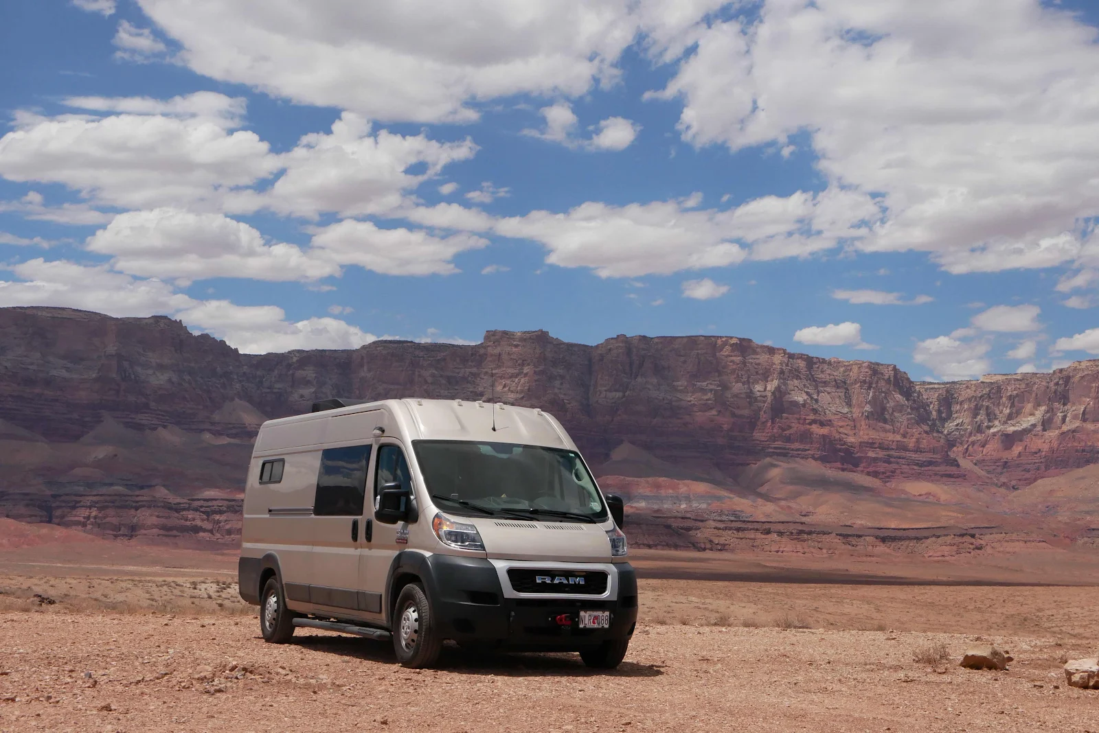
This remarkable free camping spot is listed on iOverlander but I also watched a couple on YouTube who travel with a Promaster (and a dog) and they are always looking for free campsites down whatever dirt road gets in their way - One Advanture At A Time is the name they drive under- and I was pleased to follow in their tire prints. They were here in March with slightly cooler weather and stronger winds but at 100 degrees we were quite comfortable with the afternoon breezes.

The day started after we exercised and washed and made sure every last thing was packed aboard Gannet2 and we were ready for the road. Kathy was sorry to see us go and we too were sorry to be forced to say good bye. When nomad life ends for us and if we find ourselves looking for a place to live in the US Clarkdale is definitely on the list. Saying goodbye to Kathy at eight o’clock on a 75 degree morning without sweating felt like a pretty nice start to the day. We all three reminisced about those long summer days and nights of endless heat and humidity in the Keys.

We took the slow route through Sedona but turned off toward Interstate 17 before we entered Oak Creek Canyon. This way we passed many of the famous red rock formations of Sedona though as usual I got zero energizing effect from any of the vortices we breezed past. I’d like to come back for a wander with my camera, and perhaps his winter we will get a second chance to stop here. Layne the navigator located cheap gas at Sam’s Club just east of Flagstaff, around $4.74 as I recall. Well we thought to ourselves we’ve got the Sam’s Club membership we bought in Manzanillo…Wouldn't you know it the e-card reader didn’t recognize my membership and I had to call the attendant, a really nice laid back dude who laughed and said “You’re my job security” when I apologized for the cock up. “That’s a Mexican card isn’t it?” He surprised me all right but it seems a few of the not-bar-coded membership cards from Mexico float around Arizona. No surprise really considering the proximity but he got me my ten gallons with a swipe of his courtesy card. Then we reminisced about Mexico before we got on our way and drove through the trees burnt by the recent Pipeline Fire which closed Highway 89 north of Flagstaff.

Highway 89 crests a seven thousand foot pass north of Flagstaff then the road levels off around 5,000 feet and crosses the plains toward Page, a town close by the state line with Utah. The temperature went up to the mid eighties as we rolled north around 55mph watching the other drivers acting as though gas was three bucks a gallon such a hurry were they in. We had planned to be tucked up in the national forest before the weekend but the toilet fiasco had slowed our roll and here we were riding the holiday exodus as though we had never been retired and were escaping a work week like everyone else.

We stopped at Gray Mountain just south of the Navajo Nation and while I walked Rusty, Layne made tea and tortilla wraps. Rusty enjoyed the wreckage of a motel that used to be enormous, with the luxury of a pool and now is all boarded up. I suppose Covid has had a hand in killing business along this Highway and as we went north we saw lots of Navajo jewelry stands not open.

It’s a desolate area no doubt, all we could see was yellow grass to the horizon and not a sign of life. The gas station looked wrecked but it was open and selling gas at $4.75 and they had some customers.

I’m always glad to see riders out enjoying the roads but I wasn’t envying them. I’ve ridden a lot of dead straight highways into a hot hair dryer blast of air. Gannet2 makes me happy.

When Rusty and I came around the corner I saw a man standing at the door talking to Layne. He wandered off before I got there and she said he was nuts, not making sense asking her what she was selling. Where he came from, or was going to, I have no idea. While I was wondering about him another Navajo wandered up with his hand out and we gave him a few dollars which seemed to make him happy. Layne was missing the roadside vendors we used to stop for in Mexico. This was desolation.

I don’t recall driving this Highway previously and if I had I surely would have remembered this scenery of stunning colors and formations alongside the highway. The Navajo Nation doesn’t allow dispersed camping unless you go by the tribal government and get a wilderness permit which wasn’t on the cards for us. They do have occasional turn outs along the highways with no facilities or anything but which as far as I know do permit overnight sleeping in your vehicle. On this leg of our trip we were only crossing the reservation for a few hours and had plans to camp outside the Navajo boundary on the open federal lands at Marble Canyon.

The weird thing is the strong wireless signal all along the Highway. Our Verizon phone never missed a beat, and I had expected to be offline around here but not a bit of it! The Highway itself had a few potholes and some noisy rumbly pavement, not very smooth but mostly it was pretty good and we rolled at a steady, economical 55mph.

The worst of it was the way they changed the number of lanes all the time. Instead of making it a four lane all the way, it kept varying between two lanes in one direction and then two lanes in the other to make passing easy. You could also pass in many single lane sections but passing while facing oncoming traffic is not a widely practiced skill and on this holiday weekend the road was busy. Gas prices be damned and they were driving at 75 and beyond the speed limit. We passed no one.

If you think this a long stretch of nothing be surprised: there’s gas along the way, fast food and convenience stores. I saw a public do-it-yourself laundry in the tiny collection of buildings that is Marble Canyon so there are facilities.

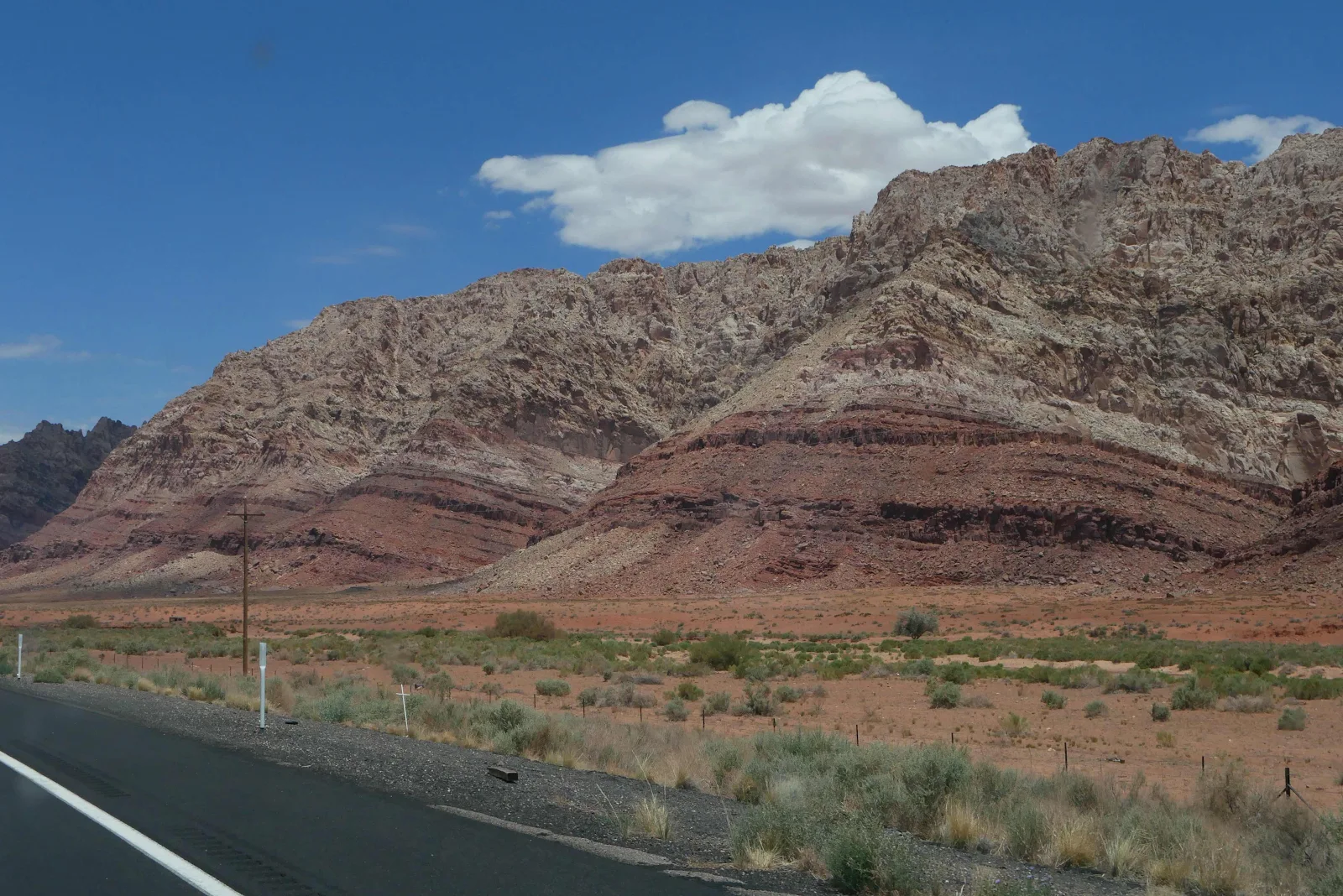
My photos from the road don’t express the true stark beauty of the colors and the cliffs of these mountains and buttes.

Not a great day for everybody.

I remember these passing lane signs from the 18 mile stretch in the Florida Keys. Note the dotted yellow line that allows safe passing before the arrival of the extra lane…


The road splits as 89 goes north to Page and the left turn becomes 89A to Marble Canyon and the North Rim of the Grand Canyon. To give you a sense of scale it’s about 150 miles from Flagstaff to Page and Google estimates a two and a half hour drive. Marble Canyon to the North Rim is 80 miles and about two hours.

We left the Navajo reservation when we crossed the Colorado River on the bridge at Marble Canyon.

Then we drove alongside the Vermillion Cliffs National Monument.

There are so many extraordinary places in Arizona.


I saw a dog face in the rock but I was probably just overwhelmed by the sights.
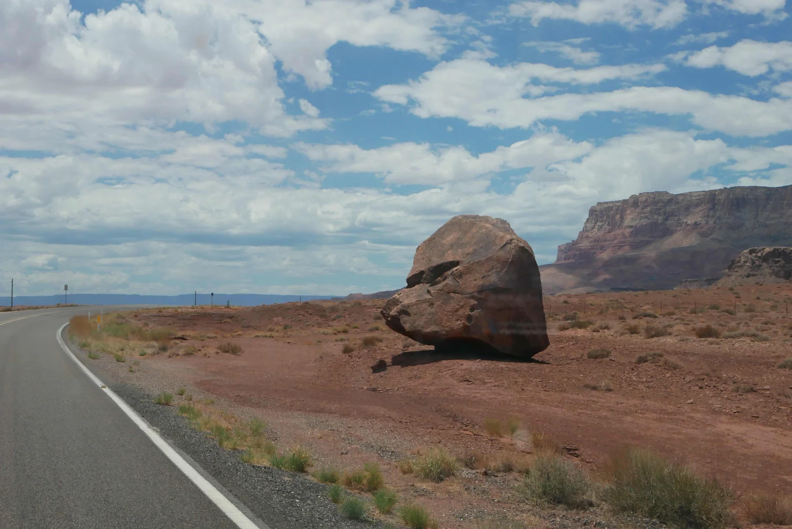
The colors.
Naturally I managed to drive past the unmarked gate and we had to find a spot to turn around. The Promaster has a nice tight turning circle which helps when you have to make a u-turn but I’d already let the few cars go by so we had the road to ourselves. The beginning of he dirt was rocky and we were bouncing like a pogo stick even though I kept us in first gear and was crawling at walking speed.

That’s the test of your mettle. If you pass the road gets smoother.

It took us twenty minutes to drive three miles to our chosen spot. We called this line of stones “Mexican guard rails” as we approached the rim of the Colorado River. We’d seen them before during our travels last winter.

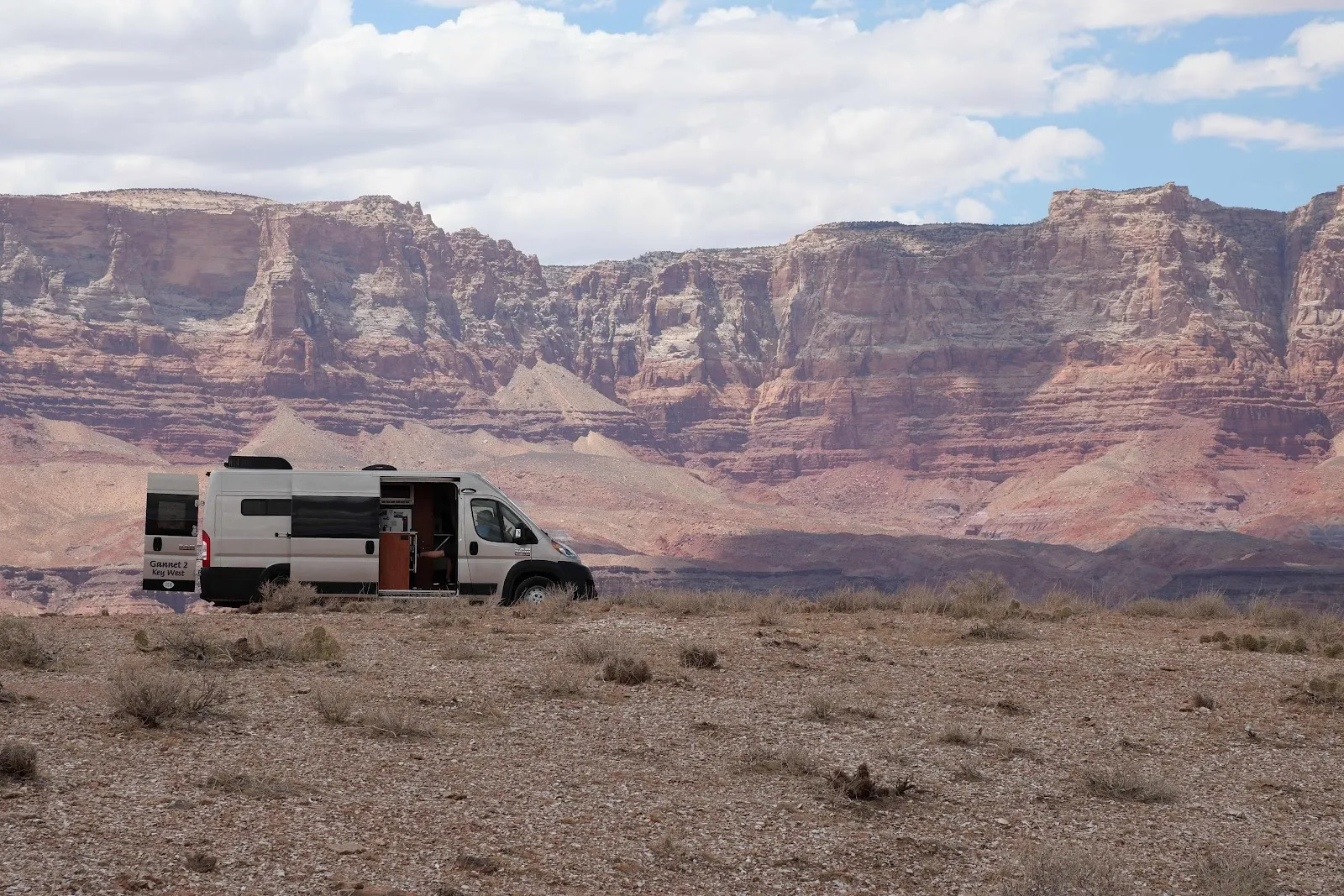
And we were not alone. We saw no one until later in the evening and I assume as they are from Colorado they were doing something nuts like climbing the canyon or similar.

There was lots of room and we drove the rim until we found a fire ring we liked which marked the camping spot. Like this one further along from our chosen spot:

The idea here is to not crush the endangered cactus so you stay on the trail and when you park you stay inside the ring of stones that delineate the dispersed camping spot. Pretty simple and just use common sense.


That’s Lee’s Ferry Lodge at Vermillion Cliffs with a Chevron station laundromat and so forth. It’s a few miles around to get there but we aren’t far from civilization.

Watch out for the endangered Brady Pincushion cactus. If this ain’t it I’m not sure what is.
Use common sense and don’t squash any cactus!

There’s lots of room to walk with care. Rusty knows to keep clear of cactus without being told.

Imagine John Wesley Powell in 1969 launching himself down this canyon with no clue what was to come. He spent three months navigating the Colorado and Green rivers while mapping the Colorado Plateau. No one died but some came close and others quit when they could but the Geographic Expedition did what they came to do. Once launched the river wasn’t going to let go of them as they rafted their way into history. I think I may need to reread the story of the journey.

I was not going too close to the edge.

But I did get a couple of pictures of the Colorado.


Rusty and I took a walk which helped me find the pictures.

He likes the desert, lots of smells and no ambushes.
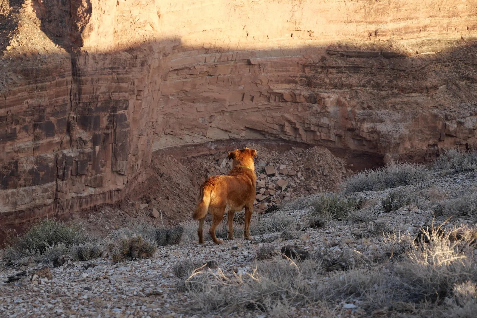
I liked the views. This one looking down the Colorado in the direction of the Grand Canyon:

I was ready for sunset with the camera while we lounged in our Cliq chairs.

I took Layne on a million dollar bet the sun would light up the sky. It didn’t.

But other than that we had a pretty spectacular day.


Rusty enjoyed the desert and ate a big dinner. We had chicken salad.

And so to bed.
