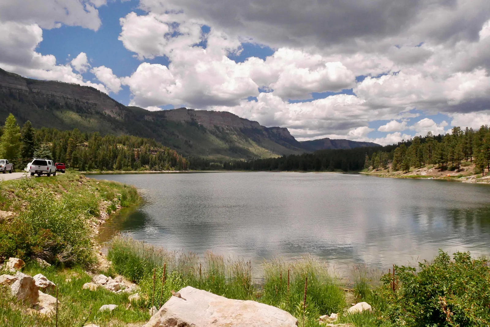
I had mentioned to Layne I wanted to include Colorado in our goodbye tour of the United States and she helped make it happen. Here we are, in the mountains practicing high altitude in preparation for the Andes. Mind you, ten thousand feet at Ophir Pass in Colorado is modest altitude compared to some places in the world. Quite stunningly beautiful though.

There are a couple of features of life at high altitude that don’t do much for me. One is sealed containers. If you take anything like that high up a mountain the contents become frantic for liberation when you later open the container. My milk looks like it has developed a powerful case of botulism and Laynes sauce bottles dribble incontinently when the lid is forced open. The self contained porta potty? That farts horribly when you open it to use it. For those reasons alone I’d recommend never straying above three thousand feet. If that. Unless you like mountain vistas, of course.

Then there are your nostrils. Avert your eyes dear reader if you had never thought about what happens to mucus membranes at high dry altitudes. The cold air fills your nose with jagged sawdust that feels like broken glass. Blowing your nose all day long gets old believe me. And what comes out can be astonishing and makes you want to run for a medical consultation. They never showed this side effect of altitude at the movies. Below is Ouray, Colorado, a mere 7800 feet above sea level, named for a defeated Indian chief who struggled to preserve his people against the ravages of the lust for gold by invaders who tore up these mountain peoples and replaced them with roads and towns. And named places for the vanquished.

We bought a ten dollar audio track for Layne’s phone when we got to Durango and had a decent phone signal. You download the audio and set the phone to play through the car speakers. In some manner I cannot describe the app senses where you are along the road and plays a description of the place you are passing. Total wizardry. Durango, which in our ongoing drive not yo get Covid we passed through enjoying the summertime gentrification from our seats:

The million dollar highway starts out flat and straight and parallels the narrow gauge railroad to Silverton which is the official start of the historic million dollar highway. The road was built between Silverton and Ouray in the 1880s to benefit gold silver and copper mining. According to the audio the road got it’s name when a local skeptic said it would cost a million bucks to build 25 miles of road which would never pay for itself.

The tape also offers side trips. This is Miracle Bridge. I was disappointed to learn the Sundance Kid was not in Bolivia at the end of the movie but here, jumping to oblivion (with a blocked up nose, no doubt):

She seemed more worried about icy water than a three foot leap:

We don’t generally get on the road very early even though I like to get up to see the dawn wherever we are parked so when the audio tape said there was a pretty spot to take lunch Layne seconded the smooth talker’s suggestion and I had hot tea while we ate cooked oatmeal and enjoyed the scenery.
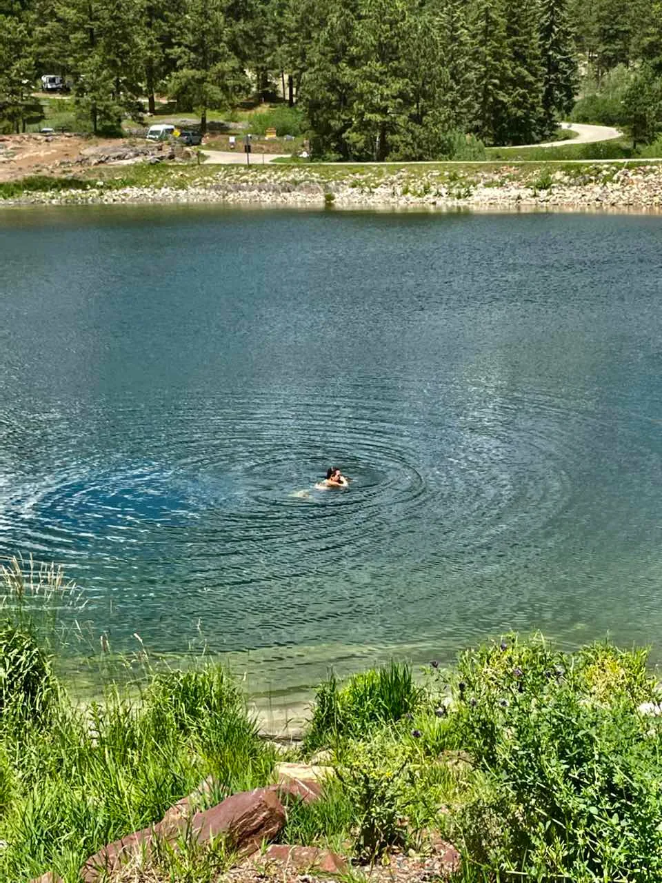
A state park with off leash dogs enjoying the water? Colorado it turns out is quite free thinking. And not just about marijuana. Rusty hated the water but he enjoyed solitary exploration while not bothering anyone.

Layne has this stupid leg lesion that needs to be removed in Tucson next week so she declined to join me. I fear I set a bad example swimming as I heard a small boy whine about wanting to swim but his father gruffly deprived the innocent of a taste of freedom by denying him the adventure. I’m 64 and if I choose to die by stupidity I am still free to do so. It was actually quite lovely and not nearly as cold as you’d think. This audio tape suggestion got thumbs up from me.
Travel beckoned and with a refreshed driver sporting flattened down wet hair as we got into the mountains proper.

It’s all very alpine and you can take your pick of movies or TV shows to remind you that these places make superb back drops to your Walter Mitty fantasies.

Traffic is I suppose heaviest in summer when schools are out and recreational vehicles of all descriptions clog the highways. Silverton marks the start of the highway in question and is the terminus of the narrow gauge railroad. It’s a pretty town set in a valley surrounded by public land. Jeeps and four wheel drives rule here. Everyone goes to work with off road tools bolted to their vehicles and roof tents and awnings and spare cans of gas marking the true outdoors adventurer. Even though gas is available everywhere and sometimes for five dollars or less per gallon.

These old mining towns have been gussied up for the likes of you and me and the million dollar gentrifiers. You just know these communities have the same old economic and housing struggles of tourist towns everywhere. Of course the winter lunatics give them a year round economy as I’m told some people quite like being cold in snow and pay good money to risk frostbite. and broken limbs riding planks in the snow. There’s no accounting for taste.

More mountains ahead. Apparently the highway gets tight and winding between Silverton and Ouray, the stretch built as a toll road in 1881 by businessman Otto Mears. He got paid to build it by the cities competing to gain access to Red Mountain and the wealth that lay there in copper silver and gold. But he also charged a toll to use his road.

We decided to stop and spend the night near here before tackling the most scenic section. If you have a self contained van the way to find a place to sleep is to drive. Ignore the state park and Forest Service organized campsites in July as they will be full of tightly packed trailers and noisy families making the most of their meager two weeks off.

As you drive you will see brown recreational type road signs that say “Forest Access” and are usually accompanied by a warning about campfires being banned this time of year. Sometimes the signage gets very specific:

What you do is take to the dirt which can be smooth gravel, or not:

And you make your way into the wilderness as far as you want or as little as you want. That’s it. Welcome to boondocking which is more properly known as dispersed camping. There are no facilities and most likely no cell service though that’s not a given. You will find areas of flattened grass and a fire ring and that is a campground. Park, relax and make a cup of tea. It’s your free spot for the night or the week. Most places have a two week maximum stay then you must move 25 miles before boondocking for up to two more weeks. Some popular spots give you only five days.

Read the signs and don’t be an asshole. That’s the number one rule in boondocking because if you spoil it by trashing the place or over staying you wreck public access for everyone. I hope that’s so obvious one need not belabor the point. A friend asked if it’s safe, and yes it is. In the wilderness even a quarter of a mile from the main road you are among a community of like minded outdoor people. We are all out here to enjoy the best places in the country absolutely free, not to murder each other.

We found our spot fifteen minutes outside Silverton at the start of the Million Dollar stretch of US Highway 550, and we were at exactly ten thousand feet down a short steep dirt road above a noisy river called Miracle Creek.


US550 to Silverton above us:

Layne cooked pasta in the Instapot and we watched the sun disappear rapidly over the mountains leaving us in a cool gray limbo until darkness fell at nine. Colorado unlike Arizona follows daylight saving so it gets light at five, not four, and gets dark at nine, not eight. Much more sensible.

A morning walk around the Ophir Bridge. The Jeep tours give their clients a thrill by avoiding the bridge and fording the river in the dirt.

Wake up to this. Layne says most people don’t like solitary camping and prefer organized campgrounds. Just as well really as we found plenty of solitude even in high season.


And then we took the road to Ouray with three mountain passes, the highest at 11,500 feet. Where, wouldn’t you know it, superhumans were riding bicycles.


The road is notable for having no guard rails. The popular myth is because they like to torture visitors. The real reason is that lunatics plow this road in winter and need room to push the snow off the road. How the plow drivers don’t kill themselves in the process I cannot understand.


It is quite stunning.


“Million dollar” sounds like hype but you owe it to yourself to see these places. Maybe rent a Corvette and take the corners properly. I pulled over less than you might imagine here because no one drives faster than GANNET2. The views are that spectacular.

Then the audio tape got active and we pulled over at a narrow spot where Mears built a toll booth that was impossible to avoid. Nowadays it’s a scenic pull out.


I always try to park facing out as it makes it easier to avoid hitting things as you leave. I think it’s a hang up from when I drove 18 wheelers and the rule for big rigs is don’t allow yourself to get blocked in by small cars in parking lots…


Ouray below, which likes to call itself Colorado’s Switzerland nestled as it is in a narrow alpine valley. They need to tidy things up a bit before they could claim to look as anally organized and civic as the Swiss.


It’s another pretty mining town and the end of the Million Dollar stretch though US 550 which starts in New Mexico ends in Montrose, Colorado.
Durango to Ouray:

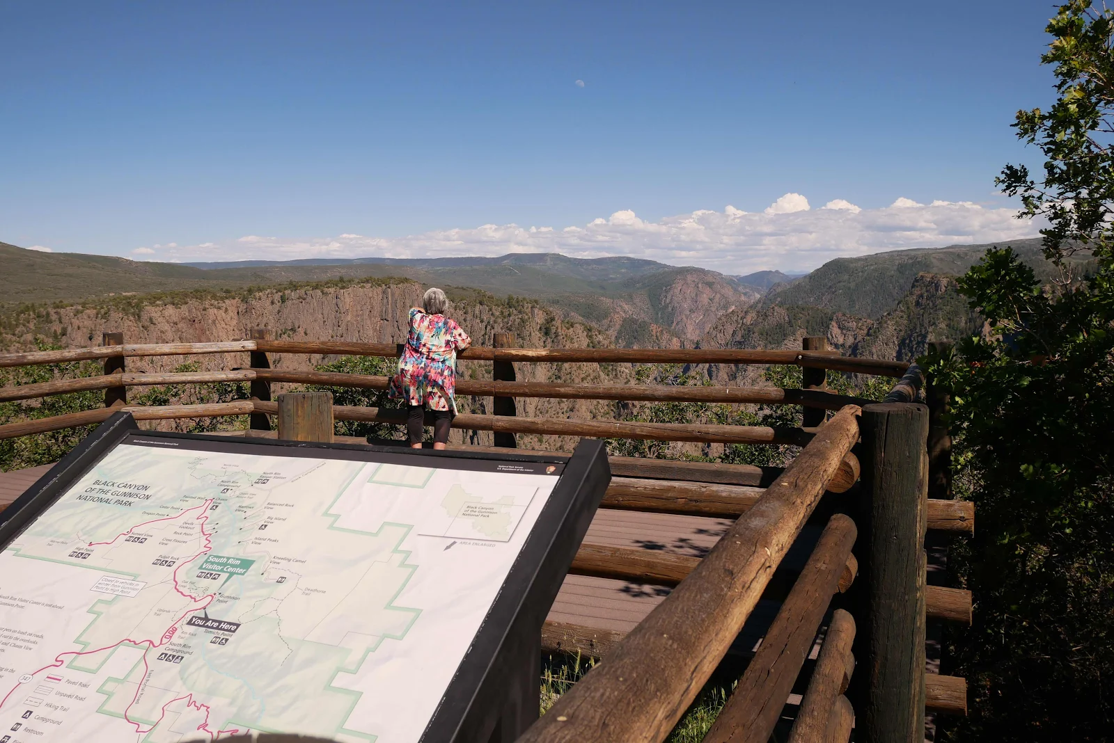
It was close to lunch time and the question was: what to do with the rest of the day? I had an idea and we set off across the agricultural flatlands toward Montrose, the end of the highway and the gateway to the Black Canyon of the Gunnison National Park. Layne ordered a pizza for pick up and we parked in Montrose in 90 degrees of unaccustomed heat and with the roof air conditioning running we had lunch. Of all the towns we passed through Montrose seemed the least affected by gentrification and the pretty downtown was the core of a city filled with services. Plus the National Park, one of the lesser known, is only an hour away.

With our Golden Age Pass we drive into National Recreation sites for free which still amazes us. No charge to enter parks monuments or historic sites. Beat that! The campground is okay but you know already what our plan was.

We were on the South Rim and we took a drive out to two overlooks that are right on the edge of the canyon and thus available to Rusty. This park is not over populated though all reserved sites were taken. I checked out of curiosity on the recreation.gov app.

The Black Canyon got its name from the dark lichen that grows on and colors the rocks. Climbing is popular here as is river rafting though both activities are said to be for experts only. The canyon is narrow, down to forty feet wide at its narrowest and spectacular course. Especially as most of the time you will be alone here.
There is a campground and rim access on the north rim as well though the parks service says you will spend up to three hours driving from one side to the other.


Climb that indeed!


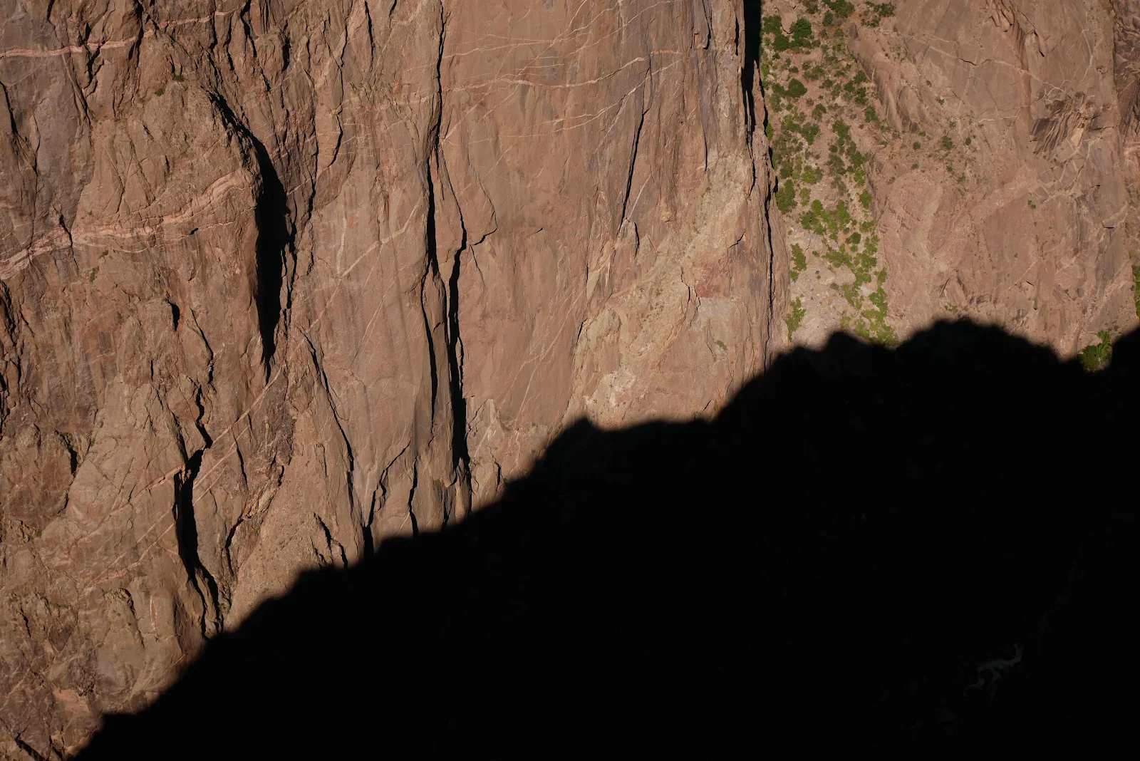
The river 2500 feet down is barely visible but you can hear it clearly rushing like a turbine through the canyon. This place isn’t the biggest or deepest or mostest of anything but I will tell you is that it is the most primitive and primeval of places. You stand right on the edge and look straight down into darkness. Surrounded as you are by rough hewn rock and your ears filled with roaring river waters this isn’t a genteel canyon visit.


Some short strolls are permitted for Rusty the patient wild dog.

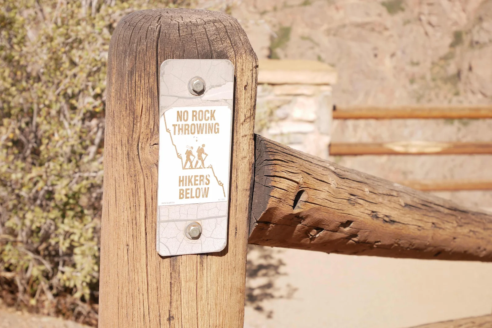
Oh and as usual people have to be reminded not to be assholes. Sigh.
Time to find that BLM (Bureau of Land Management) dispersed camping outside the park.

Done and dusted at high enough elevation to sleep comfortably in total silence among the pine trees. High enough to block my nose too of course.


Up next: Creede, Colorado.